

Springs Road East Upgrade
| What we're doing: | Springs Road (East) Upgrade |
|---|---|
| How much is it going to cost: | $11,000,000 (Council, State & Federal Government funded) |
| Timeframe: | 2024/25 Public Consultation/Concept Planning 2025/26 Detailed Design & Project Approvals 2026/27 Procurement and Start of Construction 2027/28 Project Completion |
| Background: | Springs Road between Heysen Boulevard and Bald Hills Road is an important part of councils major collector road network in that it connects Heysen Boulevard to Bald Hills Road and ultimately the Bald Hills Road freeway interchange. Councils traffic modelling suggests that the traffic volumes on this segment of Springs Road will grow to approximately 8,000 to 12,000 vehicles per day. Current volumes are approximately 2,000 vehicles per day. This estimate is dependent upon modelling assumptions as to the role other roads play (eg Alexandrina and Hartman Roads) and the direction of travel commuters are assumed to likely take. |
August 2026
The design documents are now ready and included in the procurement documents which are currently out to tender to award construction works to a preferred contractor.
July 2026
Springs Road is an important route for residents, businesses and visitors, which is why a major upgrade between Heysen Boulevard and Bald Hills Road is included in Council's Annual Business Plan.
We've heard the community's concerns about the condition of Springs Road and have taken action to improve safety while we prepare for the major upgrade.
Our maintenance team has swept debris and water from the affected section between the Summit Sport and Recreation Park and the bridge, and reapplied cold mix to repair potholes.
The road shoulder will also be excavated to improve drainage and help reduce further pothole formation until the upgrade begins.
Council has secured $5 million through the Safer Local Roads and Infrastructure Program (SLRIP) to deliver the upgrade.
The project includes widening the road, widening and strengthening the bridge, installing on-road cycle lanes, constructing a new footpath and adding street lighting and stormwater drainage to create a safer and more efficient route for all road users.
These improvements will provide a safer and more efficient route for our growing community while supporting future housing and business development.
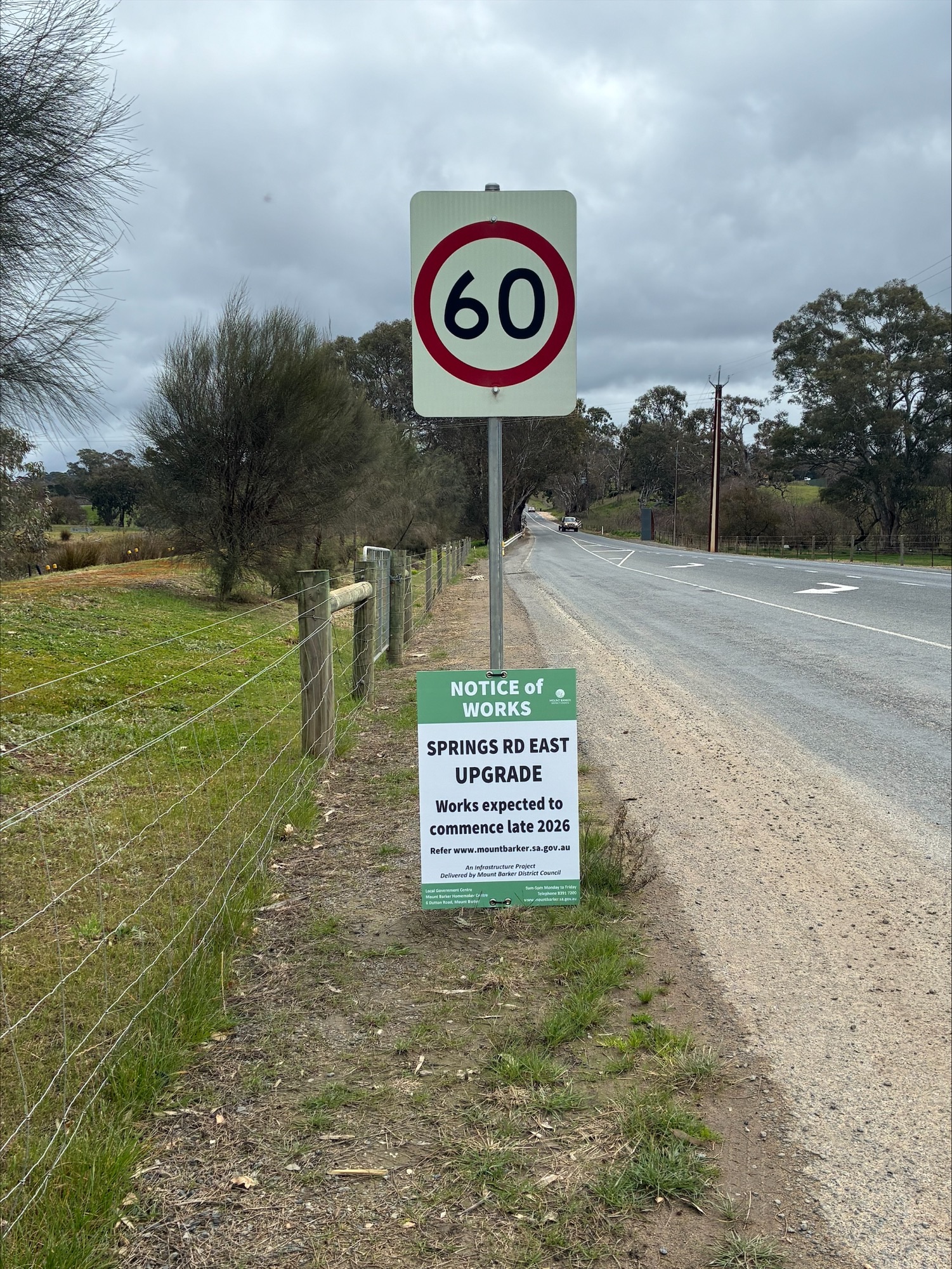
Project design is approaching completion and Council is about to commence the procurement process, with construction expected to commence in late 2026/early 2027 and be completed by January 2028.
November 2024
The community consultation has now closed.
The key themes in the feedback were associated with:
- Environmental impacts
- Pedestrian and cyclist access and safety
- Connectivity to existing infrastructure
- Scope of works
- Speed limit
The key specific feedback included the following:
- Concerns about the proposed tree removals and wildlife affected, emphasising the significance and importance of remnant native vegetation;
- Mixed response with regard to cycle lanes and footpaths, with majority supporting the proposed pedestrian infrastructure;
- Queries about how the proposed road design connects to existing infrastructure;
- Support for widening of road and bridge;
- Concerns about the recently reduced speed limit being too low on Springs Road.
Upon comprehensive review, it has been determined that many of the issues raised had already been thoroughly investigated during the initial planning process. Consequently, no amendments to the plan have been made based on the feedback received.
The 2024/25 Annual Business Plan includes detail design for Springs Road East. Subject to resourcing, the detailed design is likely to be completed within 2024/25 financial year.
An independent quantity surveyor has provided a high level cost opinion for the construction of Springs Road East upgrade based on the draft concept design. Based on the cost opinion prepared, the construction costs are likely to range from $10,000,000 to $12,000,000 in today’s dollars (excluding GST and including contingency).
On completion of the detailed design, a more refined quantity surveyor cost estimate will be prepared with a reduced contingency given the greater level of detail. Pre-tender cost estimates at the time of delivery will also be obtained to inform anticipated budget needs.
Council has recently applied for a Safer Local Roads and Infrastructure Program (SLRIP) grant for Springs Road in September 2024, which has a potential to secure $5,000,000 funding from the federal government if successful. This application was endorsed by Council at its meeting in October 2024.
Springs Road East has been listed in both the Councils Transport Infrastructure Separate Rate (TISR) and the State Government Transport Deed. The funding model therefore would likely be a 50:50 cost split with the Department for Infrastructure and Transport (DIT). A letter of support has been received to this effect.
If Council were to be successful in securing the SLRIP grant, a further report will be presented to council outlining the delivery and funding plan.
September 2024
Springs Road East plays an important role in connecting the Mt Barker growth area to the South Eastern Freeway via Bald Hills Road.
The form and function of the road currently aligns with a basic level of service applicable to a rural road with very few house frontages and low volume of vehicles.
The current road pavement is reaching end of life and will not be able to cater for the growing traffic volumes.
Abutting the road are two private rural living properties, the Summit Sports and Recreation Park (SSRP) and the site for the “Summit Precinct” which is the subject of an EOI for its implementation.
Springs Road East is experiencing rapid growth in traffic volumes since the completed construction of Heysen Boulevard between Springs Road and Paech Road. Traffic volumes have increased from 1,270 vehicles per day (vpd) in the year 2020 to 3,673 vpd in the year 2023. This equates to approximately 42% per year increase.
Currently the road presents the following issues :
- The road pavement has reached end of life and requires renewal and upgrade for the increasing traffic volumes
- The road is narrow (lanes less than 3.0m) with no shoulders in most areas and extensive edge breaks
- Narrow bridge with no width for cycle lanes, failing railing and no lead-in barriers or compliant end terminal treatments
- No cyclist infrastructure exist along or across the road
- No pedestrian facilities exist along or across the road
- No formal stormwater infrastructure other than basic roadside swales
- No public lighting, and
- Basic road intersection treatments
Springs Road East is identified in the Transport Deed made between the Minister for Transport and some Developers under Schedule 2 and 3. Therefore, this project is eligible for funding from the funds raised by the State Government from developers signed to that Deed. The contribution amount is subject to negotiation with the Department via the Transport Advisory Committee that is formed to advise the Minister on such matters.
Council staff have written to DIT to engage with them and seek their confirmation and support for the design and funding of Springs Road East upgrade.
It is envisaged that a funding mix made up of Transport Deed, Council’s Transport Infrastructure Separate Rate and other external grant funding will facilitate the delivery of the road and bridge upgrade. Council staff are currently investigating grant funding opportunities for the project and the Safer Local Roads and Infrastructure Program (SLRIP) is one such example which, if successful. could contribute up to 50% of the project cost.
Engineering design consultants have been engaged since 2021 to prepare the draft concept designs for Springs Road East road and bridge.
Pathways and trail connections are shown in the concept design that facilitate future potential routes subject to the development of a trails master plan and landholder consent.
The draft concept design includes the following:
- Compliant traffic lanes for the expected traffic volumes which will exceed 10,000 vehicles per day in the next 10-15 years.
- Bridge widening with safety barriers installed
- Pavement reconstruction
- Pedestrians and cyclist movements
- Future trail alignments
- Identification of appropriate locations for future intersections anticipated to be needed for the Summit Precinct
- Lighting at intersections and pedestrian/cyclist crossings
- Improved stormwater management
- Road safety improvements
The current draft concept design incorporates both road and bridge widening. The bridge widening is to accommodate wider lanes, cycle lanes in each direction and a footpath at the road level.
Widening of the bridge will unfortunately require some tree removals. Some of the adjacent trees are remnant native vegetation while others are exotic yet they are large and healthy with significant canopies and hence valuable. The design team has been engaged with internal and external tree experts to appraise the various trees along the road and around the bridge to minimise impacts of any upgrade.
A number of bridge widening options were investigated and a multi criteria analysis was undertaken to compare the options under these criteria and weightings. The proposed bridge widening requires realigning the road towards the rural land side, and the removal of six (6) trees. The 6 trees impacted by this option have been assessed to be the lesser number of and lesser quality trees.
The concept design is now ready for community and stakeholder engagement.
At this stage, there is no commitment to construct Springs Road East and this would need to be prioritised with other local road upgrades including Paech, Bollen, Hartmann, etc. Network modelling and the timing of funding from other sources will dictate the delivery timeframe for Springs Road East.